


To view a larger image, please click here or hover over the photo above.
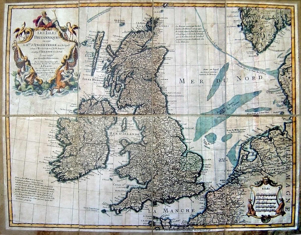
Author: De L'Isle
Year/Period: 1730
| Size: | Inches: | 39 x 31 |
| CM: | 101 X 78 |
Price: $529.99
SKU: EUR 12
Other Images:
Description:
The De L'Isle family followed the Sansons as a major influence in the development of French cartography at the beginning of the eighteen century when the Dutch mapmakers (Blaeu, Visscher, for example) were losing their influence.We suggest you to take a look at the artistic process shown on the left side step by step or by clicking on the link available on the right side of the web page see the video showing the entire artistic process.
Engraving Information:
This artistic reproduction of a vintage map was made using modern graphic procedures, but obtaining the results found in the antique copperplate engraving technique, as one can easily find out by lightly rubbing his/her finger on the map. This map, which is an exact reproduction of the original antique, is printed on cotton paper panels which are glued and mounted on a cotton cloth background "a stacchi" (slightly separated from each other), in order to allow for folding and easier transport. Finally, map is water-colored by hand making it a truly unique piece, worthy of the original old print.


