To view a larger image, please click here or hover over the photo above.
Author: Moroncelli
Year/Period: 1712
| Size: | Inches: | 22 x 17 |
| CM: | 56 X 43 |
Price: $389.99
SKU: REG 51
Other Images:
Description:
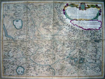
Amanzio Moroncelli (Fabriano, 1652 – Fabriano, 1719) was an Italian abbot and cartographer. As explained in the large decorative cartouche in the upper right side, this particular map ("Tavola generale dell'Umbria nuovamente corretta ed ampliata secondo lo stato presente") was published by Domenico de Rossi in its shop in Rome and was dedicated to Mons.Scipione de Ricci Fiorentino. Map was copper engraved on a single sheet. Normal orientation with longitude calculated from the meridian of the island of Cape Verde. Prospective orography shown with hills. Urban centers are schematically shown with towers and houses or small circles based on their level of importance. Geographical borders and the road network are shown. Graphich scale in Italian miles and French leghe.
Engraving Information:
This artistic reproduction of an antique map was made using the same techniques, materials and instruments used for the original. Map is created from a zinc slab that is mounted on a wooden base and printed by hand, a piece at the time, on a press with a limited production size of 20 pieces each time. Map is printed on cotton-paper panels which are glued and mounted on a cotton cloth background "a stacchi" (slightly separated from each other), in order to allow for folding and easier transport. Finally, map is water-colored by hand, making it a truly unique piece, worthy of the original vintage map.Useful Links (provided by Wikipedia):
Useful Link 1


