


To view a larger image, please click here or hover over the photo above.
Author: Bulifon / Cassianus
Year/Period: 1700
| Size: | Inches: | 43 x 29 |
| CM: | 110 X 75 |
Price: $859.99
SKU: REG 134
Other Images:
Description:
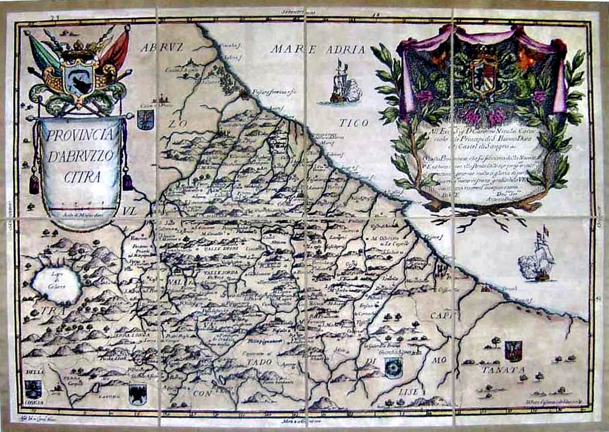
This map shows the Abruzzo Citra which was an administrative unit of the Kingdom of Sicily (Regno di Sicilia), then part of Kingdom of Naples (Regno di Napoli).
Abruzzo Citra or Abruzzo Citeriore was a province of the Kingdom of Naples, established by Charles of Anjou when he divided ( year 1273) Giustizierato of Abruzzo (founded by Frederick II) into two parts: Ultra flumen Aprutium Piscariae (Aprutium beyond the Pescara river) and Aprutium citra flumen Piscariae (Aprutium this side of the Pescara river) .
This map shows Abruzzo Citra who was located south of the Pescara river and within the river area of today’s Abruzzo region of Italy, for the most part within the present Province of Chieti; the seat was the city of Chieti.
The borders Map is characterized by a large cartouche in upper right corner with dedication to Prince Carmine Nicolo' Caracciolo, Duke of Castel di Sangro and shows the expressive capability of Blaeu which marries artistic sense with informational content.
Engraving Information:
This artistic reproduction of a vintage map was made using modern graphic procedures, but obtaining the results found in the antique copperplate engraving technique, as one can easily find out by lightly rubbing his/her finger on the map. This map, which is an exact reproduction of the original antique, is printed on cotton paper panels which are glued and mounted on a cotton cloth background "a stacchi" (slightly separated from each other), in order to allow for folding and easier transport. Finally, map is water-colored by hand making it a truly unique piece, worthy of the original old print.
Useful Links (provided by Wikipedia):
Useful Link 1


