To view a larger image, please click here or hover over the photo above.
Author: Domenico de' Rossi
Year/Period: 1714
| Size: | Inches: | 42 X 34 |
| CM: | 106 X 86 |
Price: $539.99
SKU: REG 70
Other Images:
Description:
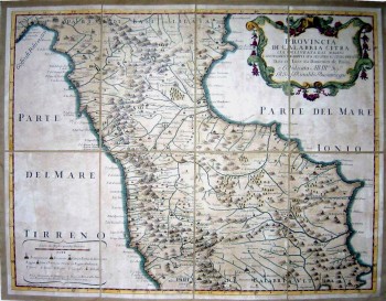
This map was published in Rome in 1714 by Domenico de' Rossi. He hailed from the de' Rossi family who owned and operated the most important and active printing press of the 17th century in Rome, which in 1738 became known as the Calcografia Camerale, from 1870 until 1945 the Regia Calcografica, and today it is known as the Calcografia Nazionale. An uncommon late 17th century map of the northern part of Calabria , based on the reports of Giacomo Cantelli da Vignola and dedicated to a Mr. Rinaldo Buoninsegni.
The map is a tremendous example of the fine topograpical style of Rossi's maps, elegantly tracing rivers through steep and well defined mountain valleys. Includes a key in the lower left, depicting the symbols used on the map and a large ornamental title cartouche in the upper right corner.
Engraving Information:
This artistic reproduction of a vintage map was made using modern graphic procedures, but obtaining the results found in the antique copperplate engraving technique, as one can easily find out by lightly rubbing his/her finger on the map. This map, which is an exact reproduction of the original antique, is printed on cotton paper panels which are glued and mounted on a cotton cloth background "a stacchi" (slightly separated from each other), in order to allow for folding and easier transport. Finally, map is water-colored by hand making it a truly unique piece, worthy of the original old print.
Useful Links (provided by Wikipedia):
Useful Link 1


