


To view a larger image, please click here or hover over the photo above.
Author: Janssonius
Year/Period: 1640
| Size: | Inches: | 40 x 32 |
| CM: | 102 X 82 |
Price: $779.99
SKU: REG 30
Other Images:
Description:
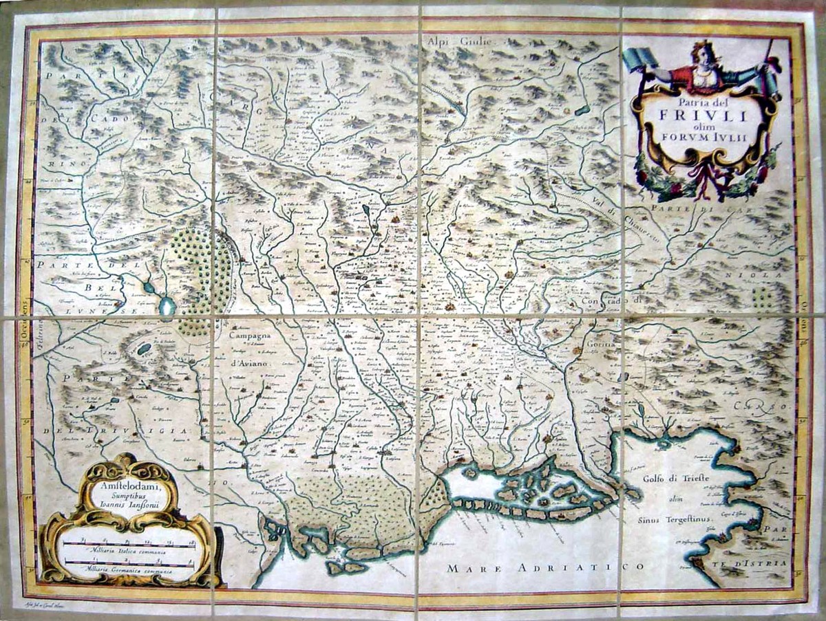
Johannes Janssonius (1588-1664) was a Dutch cartographer who lived and worked in Amsterdam in the 17th century. He produced his first maps in 1616 of France and Italy. In the 1630s he formed a partnership with his brother in law Henricus Hondius, and together they published atlases as Mercator/Hondius/Janssonius, best known of which is the "Atlas Novus" published in 3 volumes in 1638, one fully dedicated to Italy. This specific map is a nice old color example of Jansson's map of Friuli, extending from the Gulf of Trieste and the Alps to Belluna and centered on Udine.
Decorative title cartouche on the right upper corner.
Engraving Information:
This artistic reproduction of a vintage map was made using modern graphic procedures, but obtaining the results found in the antique copperplate engraving technique, as one can easily find out by lightly rubbing his/her finger on the map. This map, which is an exact reproduction of the original antique, is printed on cotton paper panels which are glued and mounted on a cotton cloth background "a stacchi" (slightly separated from each other), in order to allow for folding and easier transport. Finally, map is water-colored by hand making it a truly unique piece, worthy of the original old print.
Useful Links (provided by Wikipedia):
Useful Link 1


